Dunbible: Dunbible Creek Railway Bridge

Dunbible is one of those far North Coast New South Wales towns on the former Murwillumbah railway line with an interesting sounding name that makes you curious as to what you might see. The answer in short is nothing. Despite being only 6 km south of Murwillumbah Railway Station, and a former station stop of the New South Wales Government Railways, apart from a disused railway crossing on Stokers Road, there was nothing to see of Dunbible Station but some nearby cows.
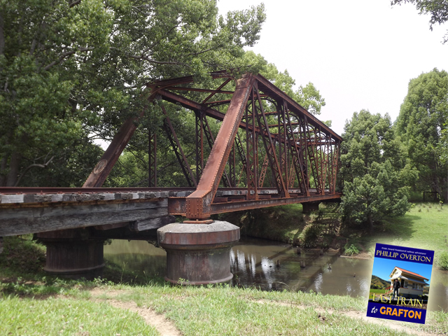
Like the nearby town of Stokers Siding, Dunbible Railway Station was marked as closed on June 30, 1974. Just like Stokers, Dunbible Station was marked as 'stops only if required' in my copy of the May 1972 New South Wales Railways Country Timetable. Today the former station site is fenced off on both sides of Stokers Road and is frequented only by livestock. However, a little further down the road towards Stokers Siding, there is a hidden gem spanning the tree-lined Dunbible Creek. The Dunbible Creek Railway Bridge.
 |
| Dunbible Creek Railway Bridge on the Murwillumbah railway line, 2014. |
Before I went tramping off into the bush in search of the old railway corridor however, I first stopped my car to talk to a local farmer. After explaining who I was, he gave me permission and directions of where to park my car in order to walk through his property to where the bridge is located. There is a lot of heated opinion on both sides of the debate over what should come of the old Murwillumbah branchline, and for as many advocates there are of the Northern Rivers Rail Trail, there are just as many detractors. Such as this farmer who wasn't fond of the thought of people wandering through the middle of his farm at all hours of the day. Considering the height of the wild grass and scrub that has reclaimed parts of the rail corridor, I for one would just like to see a decision made so that farmers such as the one I spoke with can at least clear the weeds that are obscuring their property.
 |
| The overgrowth on the line through Dunbible can clearly be seen behind me from the railway bridge, 2014. |
When the original NSWGR North Coast Line was built south from Murwillumbah in 1894, Dunbible Creek would have been the first major obstacle the railway gangs had to traverse just 6 km out of Murwillumbah. All up there are 158 bridges on the 132 km Murwillumbah Line. That's more than 1 bridge per km. Most of these however are timber trestle bridges, and not the steel through truss bridge that I am pictured standing in front of which became an American inspired hallmark of the entire North Coast Railway Line. So far I haven't been able to find any information to suggest that the bridge was the original one constructed when the North Coast Line first opened in 1894. By all accounts it is. The presence of the narrow wooden pylons in the creek bank as shown in the photos, suggest that they were placed there in order to raise the steel truss into position during construction, before being removed once the bridge was complete. Something that was a common practice of the time.
 |
| Dunbible Creek Railway Bridge is a highlight on the old railway line between Murwillumbah and Stokers Siding. 2014. |
Whether I get to return in the future to walk part of the former Murwillumbah Railway Line remains to be seen. There are many great ideas that have been put forward with what should be done with the old railway track, but 10 years after the last XPT rolled south across Dunbible Creek Railway Bridge, I think its safe to say I won't be catching a train any time soon.
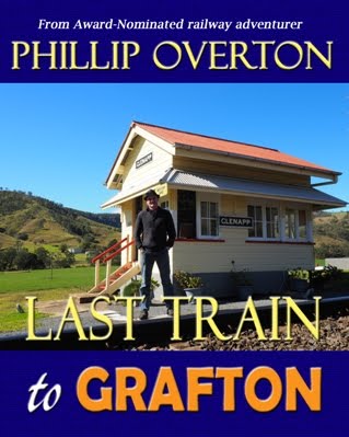
Visiting Dunbible Creek Railway Bridge was one of the highlights from producing my railway photographic book Last Train to Grafton, and is available now in full colour print.
Visiting Dunbible Creek Railway Bridge was one of the highlights from producing my railway photographic book Last Train to Grafton, and is available now in full colour print.


Comments
I enjoyed your article on the Dunbible Creek railway bridge. I can confirm that this bridge was constructed around 1894, during the building of the Casino to Murwillumbah branch line.
This bridge, along with four (4) other similar truss bridges along the line are of wrought iron construction, a metal used in bridge construction before the wide adoption of steel.
The other truss bridges are located at Pearces Corner, Eltham, Bexhill and Lismore, all of which I have photographed in the late 1990s.
I am a bridge design engineer with a keen interest in the history of bridges in NSW.
Regards,
Ken Maxwell
Aboriginal word refers to 'djunbi tree', with suffix following (-ible) indicating there were many of these trees there. Also: 'a creek at the foot of a high mountain', is a descriptive rather than literal translation. (Richmond Tweed Regional Library; 1984). Also: a slip for 'Tunbible', which is a type of tree (the tunbi tree) with suffix -bil meaning 'plenty of'. (M.Sharpe) http://www.oktravel.com.au/au/nsw/tweed/dunbible/
Alternate etymology: "Dunbible Creek got its name from the following incident: An old pioneer was reading his Bible on the (creek) banks. When he had finished he was crossing the creek on a log bridge when the Bible fell into the creek. His Aboriginal companion remarked, “Done Bible, boss” and Dunbible it has been to this day.” https://www.tweeddailynews.com.au/news/place-names-attract-intrigue/650164/